![]() DOWNLOADS
DOWNLOADS
EXTRA MAP 1
MUSIC & 12 questions
This is just an example to get fimiliar with the concept of
EXTRA maps.
* Start by downloading MAP2.zip download
and unpack the files.
You will get
MAP2.jpg and 2map.txt
* Copy the files to directory ATLAS10 on your tablet.
* Enter SETUP and switch EXTRA on.
Of course you can change the names of the files to let them appear as the alternative to an other map.
Take the next step: make a map of your own.
EXTRA
MAP 2
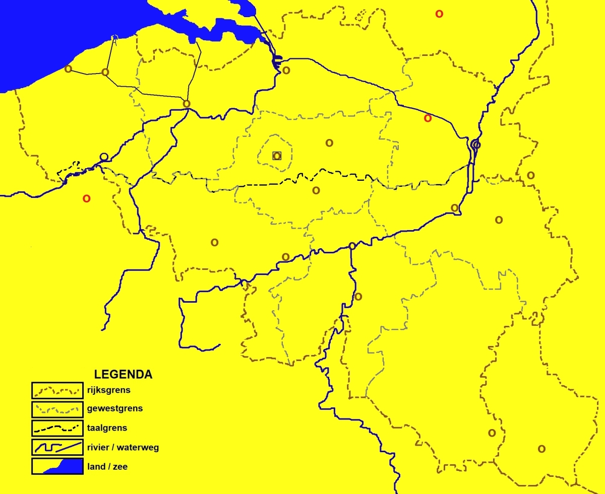
BELGIUM & 36 questions/with or without
symbols
An authentic ATLAS11 (hand drawn) map in cartoon
style, .
* First: Download BELGIE.zip and unpack the files.
* Make your choice: MAP20 or MAP21? Of course you can rename the files to
put them on the location of your choice. E.g. MAP8.jpg will replace South
Netherlands.
* Copy the files you want to use to your tablet in directory ATLAS10.
* In ATLAS10, enter SETUP and switch EXTRA on.
It is possible that the question marks are a
bit too far to the east. That is caused by the differences in tablet screens.
This map was drawn on a 1280x800 tablet
and maybe yours has different values in width and/or height.
Can the problem be solved? For sure. Enter 21map.txt with a text editor and
make some corrections to the x-coordinates (the first number after the
name). Most of the time 2-4 more can be enough. The problem is greater on
cities and smaller on provinces. In the west less than in the east.
If you ever make your own map, you will not encounter this problem, because your design starts on your own tablet.
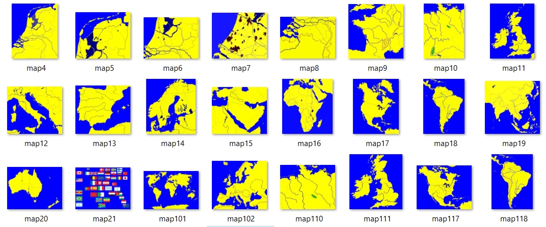
ALL INTERNAL MAPS & more from ATLAS11
If you download and unzip all internal maps of ATLAS10 you
are free to change the details and add new roads, cities and rivers.
Download here
a ZIPfile with existing maps as well as the files with coordinates and
names.
That information gives a lot of insight in how it all works and you can
change whatever you like.
Possibilities:
* Arrange the maps in an other sequenze, by renaming them. Then copy the
files to directory Android/data/ATLAS11.pro.td/files/ATLAS11 in the root of your tablet. Do not forget to
switch on the option EXTRA in the Setup section of the app.
* N.B: You also can use the maps 102 (Europe mountains) or 110
(Germany North) and 117 (US & Canada).
* You can use all possibilities of your photo-editor: drawing,
changing or removing some or all colours, picture in picture, add text, etc.