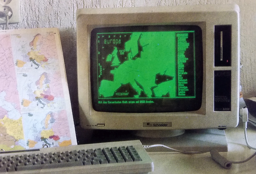
The app ATLAS10 has a long series of ancestors
The German version has been published in JOYCE Sonderheft Nr. 4, DM Verlag, Eschwege
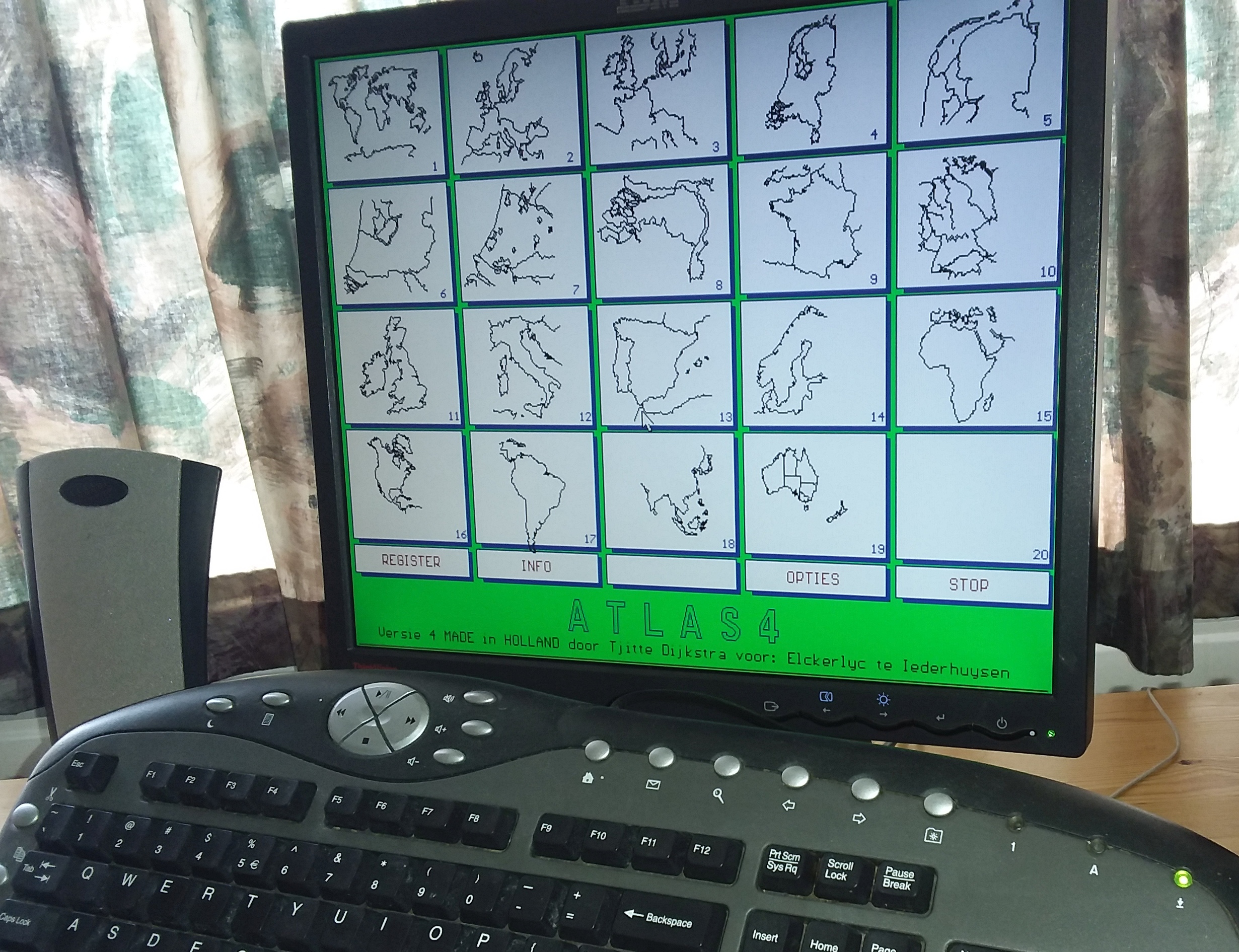
If you have a working XP-computer, don't hesitate and download ATLAS4 here
ATLAS11 Topography app with more extra possibilities (2022)
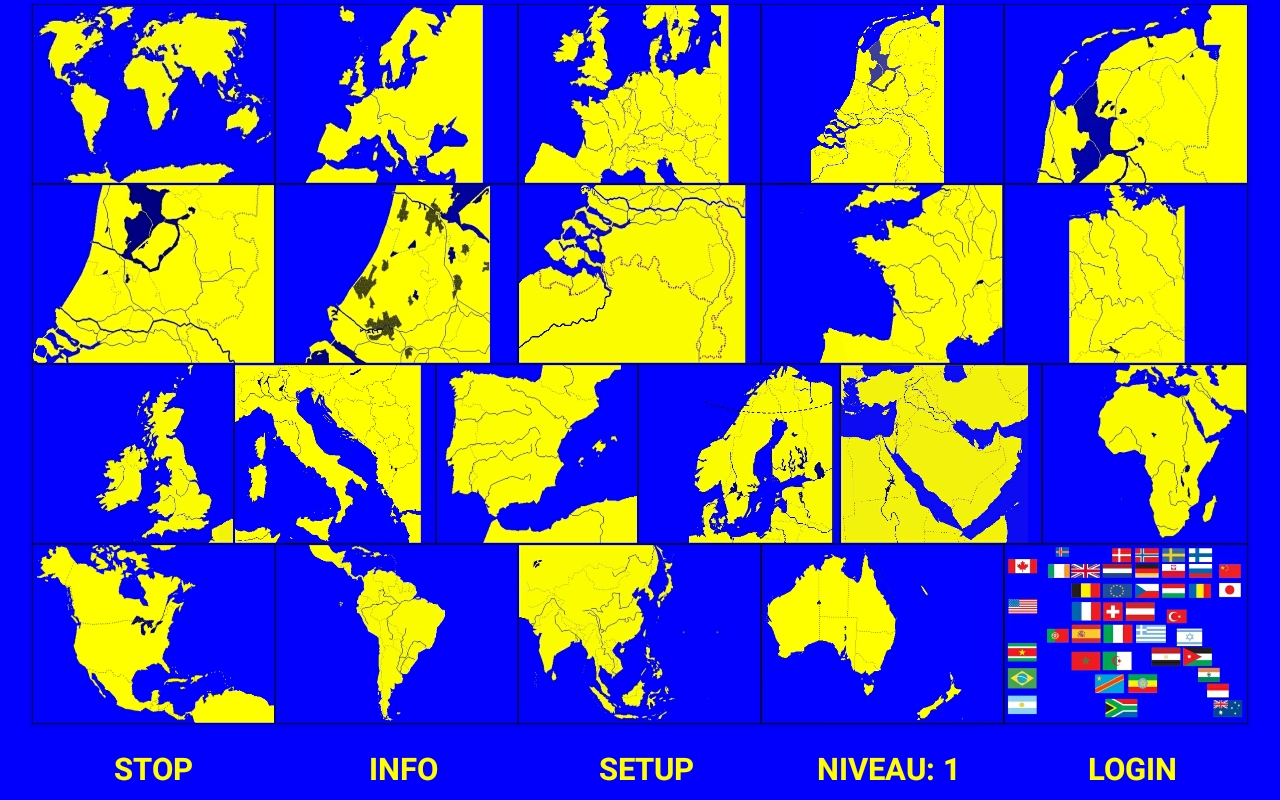
As we see: ATLAS11 is a child of ATLAS4
ATLAS9 is a free trial version of ATLAS11. So: if all works fine on your tablet, you can decide to purchase ATLAS11.
You can use the app on a smartphone, but a 7" tablet is better.
The price can be as low as € 2,19 because the maps are
home-made. No copyright.
So: download ATLAS9 and give it a try: does it fitt your tablet?
ATLAS9 & ATLAS11 are available in the Google Play Store (starting medium May
2020)
![]()
Maybe I will organize an elementary story book for young children?
Maybe a digital reference book for a museum or an exhibition?
The language Basic B4A (For Android) is far from difficult, as you can see in the example to the right. There are two lists (for X & Y) and that lists are filled with coordinates, etc.
B4A: Clear and clean?
1 Sub
Kompasplaatsen2 Dim KompasX, KompasY As List
3 KompasX.Initialize : KompasY.initialize
4 KompasX.AddAll(Array As Int(2,37,2,2,2,10,2,2,2,2,2,2,60,7,2,71,51,4,2,2,2))
5 KompasY.AddAll(Array As Int(2,1,2,2,2,8,2,2,2,50,2,35,88,78,2,2,2,30,17,2,10))
6 If kaartnr <> 21 Then
7 Kompas.Visible = True
8 Kompas.Left = KompasX.Get(kaartnr)*1%x*CX+Links
9 Kompas.Top = KompasY.Get(kaartnr)*1%y
10 Else
11 Kompas.Visible = False
12 End If
13 End Sub